The Ultimate Muktinath Road Trip
The overland expedition from the subtropical valleys of central Nepal to the arid, trans-Himalayan plateau of the Mustang district represents one of the most geographically profound road journeys in the Himalayas. Historically, the sacred temple of Muktinath—perched at an elevation of 3,710 meters—was accessible only via an arduous, multi-day trek along the Annapurna Circuit, requiring travelers to surmount the 5,416-meter Thorong La Pass or endure a grueling hike from the wind-swept airstrip in Jomsom. However, the aggressive infrastructural expansion of the Kali Gandaki Corridor has fundamentally altered the accessibility of this region. The deployment of heavy earth-moving machinery and the application of Double Bituminous Surface Dressing (DBSD) technology on critical segments of the route have inaugurated a new era of overland travel.
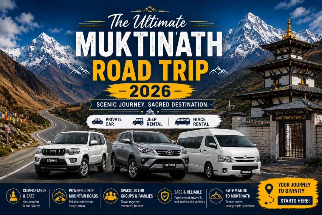
Today, the Muktinath road trip facilitates a seamless transition through extreme topographical zones, made viable through the utilization of specialized 4WD vehicles, including rugged Jeeps, robust SUVs, and high-clearance Hiace vans. This journey is not merely a logistical transit; it is a highly concentrated immersion into both geological extremes and religious synchronicity. The route traces the Kali Gandaki Gorge, acting as a historical conduit for the ancient salt trade between Tibet and India, and stands today as a profound pilgrimage vector. For Hindus, the destination is Mukti Kshetra—the “Place of Salvation”—where liberation from the cycle of rebirth is attained. For Buddhists, it is Chumig Gyatsa, the “Hundred Sacred Waters,” sanctified by the Tantric master Padmasambhava. By merging advanced vehicular logistics with deep spiritual heritage, this overland route democratizes access to the high Himalayas, allowing elderly pilgrims, families, and time-constrained adventurers to experience a landscape once reserved exclusively for seasoned mountaineers.
Trip Highlights of Muktinath Road Trip
The expedition through the Kali Gandaki corridor is characterized by a dense concentration of unparalleled geographic and cultural landmarks. The seven most profound highlights of this journey include:
1. Traversing the Kali Gandaki Gorge The journey is anchored by the transit through the Kali Gandaki Gorge, universally recognized as the deepest canyon on Earth. Carved by the antecedent Kali Gandaki River, the gorge physically separates the towering Dhaulagiri massif (8,167 meters) to the west and the Annapurna massif (8,091 meters) to the east. The vertical relief from the riverbed to the surrounding peaks exceeds 5,500 meters, offering travelers in a 4WD vehicle an unmatched perspective of tectonic uplift and extreme erosional forces.
2. Ritual Purification at the 108 Muktidhara Spouts Upon reaching the Muktinath temple complex, the central ritualistic highlight is the Muktidhara—a semicircular arrangement of 108 brass water spouts shaped like boars’ heads. Sourced directly from freezing glacial springs, these spouts hold immense cosmological weight. In Hindu theology, the number 108 signifies cosmic completeness, mirroring the beads on a prayer mala, while in Buddhism, it represents the cleansing of the 108 defilements of the mind. Pilgrims undertake a rapid, sequential run beneath the freezing streams to cleanse karmic impurities before entering the main shrine.
3. The Eternal Flame of Jwala Mai Located in a small Tibetan-style monastery adjacent to the main Vishnu shrine, the Jwala Mai temple houses one of the Himalayas’ most compelling natural anomalies: an eternal flame. Fueled by subterranean natural gas venting continuously through a small fissure, the flame burns directly above an underground water stream. This co-location of earth, water, and fire without mutual destruction is interpreted by both Hindu and Buddhist practitioners as a manifestation of ultimate divine balance and an inherent sacredness embedded in the local geology.
4. Foraging for Shaligram Fossils in Kagbeni The gravel beds of the Kali Gandaki River, particularly around the medieval village of Kagbeni, are the exclusive global repository for Shaligram stones. These heavy, black, fossilized ammonites date back approximately 150 million years to the Jurassic era’s Tethys Ocean. The journey affords travelers the opportunity to comb the riverbanks for these fossils, which are strictly venerated in Vaishnavism as the non-anthropomorphic, self-manifested embodiments of Lord Vishnu, bearing the distinct spiral markings of his divine discus (chakra).
5. Exploring the Apple Orchards and Architecture of Marpha As the vehicle ascends into the arid rain shadow of the Himalayas, the village of Marpha emerges as an unexpected agricultural oasis. Renowned as the “Apple Capital of Nepal,” the settlement is defined by its immaculate Thakali architecture—featuring flat-roofed, whitewashed stone houses, flagstone-paved alleys, and sophisticated subterranean irrigation channels. The village provides a stark visual and economic contrast to the surrounding desert, producing highly celebrated apple cider and brandy that sustain the local micro-economy.
6. Experiencing the Trans-Himalayan Desert Landscape Passing beyond the village of Ghasa, the ecological transition is absolute. The humid, subtropical vegetation of the lower Annapurna region terminates abruptly, giving way to the trans-Himalayan desert of the lower Mustang district. Travelers are enveloped by a landscape of wind-carved sandstone cliffs, vast scree slopes, and ancient, inaccessible cave dwellings carved into vertical rock faces, offering a visual environment that is practically indistinguishable from the high Tibetan plateau.
7. Immersion in the Medieval Village of Kagbeni Serving as the historical checkpoint and gateway to the restricted Kingdom of Upper Mustang, Kagbeni represents an intact remnant of medieval Tibetan fortification. Situated at the confluence of the Kali Gandaki and Jhong rivers, its architecture features densely clustered mud-brick houses built tightly together to deflect the fierce valley winds. The presence of an active 15th-century monastery, ancient chortens, and prayer flags creates an atmosphere deeply saturated in traditional Tibetan Buddhist and older Bon religious practices.
What to Expect
Executing a vehicular expedition from the mid-hill region of Nepal to the high-altitude frontier of Mustang requires comprehensive preparation for extreme environmental variability, physical endurance, and logistical flexibility.
Foremost, travelers must anticipate a dramatic and rapid escalation in altitude. The journey initiates in the low-lying Kathmandu or Pokhara valleys (ranging from 820 to 1,400 meters) and climaxes at the Muktinath temple complex at 3,710 meters. This sudden vertical gain introduces the physiological risk of Acute Mountain Sickness (AMS). As oxygen density decreases, passengers may experience headaches, lethargy, and shortness of breath. Consequently, the expedition necessitates a measured pace, incorporating strategic overnight halts at intermediate altitudes—such as Jomsom (2,743 meters)—to facilitate biological acclimatization before the final ascent.
Meteorologically, the Kali Gandaki Valley is defined by localized, high-velocity wind patterns. Due to massive thermal pressure differentials between the heated southern plains and the frigid Tibetan plateau, gale-force updrafts funnel through the gorge daily. By mid-morning, the valley floor from Marpha to Kagbeni transforms into a turbulent wind tunnel, whipping up substantial dust storms and complicating travel. Therefore, travelers must expect rigorously early departure schedules—often pre-dawn—to execute the drive to Muktinath and return to lower elevations before the thermal winds peak.
In terms of infrastructure, travelers must recalibrate their expectations of a “highway.” While segments near Pokhara and the final ascent from Kagbeni feature recent blacktop paving, the core transit zone between Beni and Jomsom consists of a grueling, unpaved, rock-strewn track carved directly into unstable cliff faces. The ride is inherently turbulent, characterized by persistent bumping, deep ruts, and seasonal river crossings. The deployment of heavy-duty 4WD SUVs mitigates the physical toll, but passengers must maintain a high tolerance for rugged off-roading. Ultimately, the juxtaposition of this savage wilderness against the profound spiritual devotion witnessed at the temple complex defines the core character of the Muktinath road trip.
Muktinath Tour Package from Kathmandu
A comprehensive eight-day operational itinerary originating from Nepal’s capital ensures a holistic trans-Himalayan experience, systematically managing altitude gains and providing ample opportunity for cultural immersion across the Kathmandu and Pokhara valleys.
Day 01: Arrival in Kathmandu
The expedition commences with logistical staging at Tribhuvan International Airport (1,400 meters). Ground personnel facilitate a private transfer to the designated hotel within the Kathmandu Valley. This initial day is allocated for rest, acclimatization, and a comprehensive briefing with the tour operator regarding the upcoming altitude profile, weather forecasts, and the finalization of necessary trekking and conservation permits.
Day 02: Kathmandu – Drive to Pokhara
The overland journey initiates with a 200-kilometer transit westward to the lake city of Pokhara. Navigating the Prithvi Highway, the vehicle traces the contours of the glacier-fed Trishuli and Marsyangdi rivers. While digital mapping systems may indicate a 5 to 6-hour transit time, the reality of localized construction, heavy outbound commercial traffic, and topographical bottlenecks dictates an average driving duration of 7 to 9 hours. Utilizing a private vehicle allows for customized climate control and spontaneous halts at suspension bridges or local agricultural stands, eliminating the rigid exhaustion associated with public transit.
Day 03: Pokhara – Drive to Jomsom
Departing the subtropical environment of Pokhara (820 meters), the expedition pushes northwest. The initial 85 kilometers to Beni are smoothly paved, but upon crossing the settlement, the true Himalayan off-road sector begins. The 4WD vehicle initiates a grueling, multi-hour climb alongside the Kali Gandaki River, navigating the deep gorge past the hot springs of Tatopani and the towering Rupse Waterfall. Crossing the ecological threshold at Ghasa, the landscape shifts dramatically into the arid Mustang rain shadow. The vehicle passes the apple orchards of Marpha, arriving in the administrative hub of Jomsom (2,743 meters) for a strategic acclimatization overnight halt.
Day 04: Drive to Muktinath, then Pokhara
This is the operational climax of the journey. To circumvent the intense afternoon valley winds, the vehicle departs Jomsom before dawn. The route covers a 20-kilometer ascent, passing the medieval fortress of Kagbeni, and utilizes the newly paved DBSD-blacktopped road for the steep climb up to the Muktinath base (3,710 meters). Travelers disembark and execute a short 30-minute hike—or utilize pony rentals—to reach the temple complex. Following the completion of purification rituals at the 108 spouts and darshan at the main shrine, the expedition immediately begins a sustained, multi-hour descent. The vehicle retraces the entirety of the rocky gorge route, managing a significant drop in altitude to return the party to the oxygen-rich environment of Pokhara by late evening.
Day 05: Pokhara Tour
Following the physical demands of the high-altitude transit, this day is dedicated to recuperation and localized exploration within the Pokhara Valley. The itinerary traditionally begins with a pre-dawn drive to the Sarangkot viewpoint (1,600 meters) to witness the sunrise illuminating the Annapurna and Machhapuchhre massifs. Subsequent activities include a boating excursion on the serene Phewa Lake, visiting the island-bound Barahi Temple, exploring the subterranean Gupteshwor Mahadev Cave, and observing the intense subterranean water flow at Davis Falls.
Day 06: Pokhara – Drive to Kathmandu
Travelers initiate the return transit to the capital. The eastward journey along the highway provides a secondary opportunity to observe the riverine landscapes, deep gorges, and terraced agricultural fields, culminating in an evening arrival back in the Kathmandu Valley after a 6 to 7-hour drive.
Day 07: Kathmandu Tour
Before concluding the expedition, a deep cultural immersion in the Kathmandu Valley is undertaken. The standard sightseeing circuit encompasses several UNESCO World Heritage Sites. Travelers explore the intricate wooden architecture of Kathmandu Durbar Square, the towering Buddhist mandala of Swayambhunath (the Monkey Temple), the colossal dome of Boudhanath Stupa, and the sacred Hindu cremation ghats on the banks of the Bagmati River at the Pashupatinath Temple.
Day 08: Airport Departure
The expedition concludes with final hotel check-outs. Ground transport coordinates with international flight schedules, providing private transfers to Tribhuvan International Airport to facilitate seamless onward travel, officially ending the eight-day itinerary.
Muktinath Tour from Pokhara (1 Night / 2 Days)
For domestic travelers, expatriates, or international visitors operating under severe temporal constraints, the Pokhara-to-Muktinath segment can be compressed into a highly intensive, two-day overland sprint. This aggressive itinerary is only viable with specialized 4WD transport and experienced drivers capable of enduring long operational hours.
Day 1: Pokhara to Jomsom / Ranipauwa Originating directly from Pokhara in the early morning, the vehicle executes a relentless push northward. The objective is to clear the blacktopped section to Beni and tackle the grueling off-road gorge sector through Tatopani and Marpha in a single, 8 to 10-hour drive. Depending on daylight, road conditions, and the passengers’ tolerance for altitude, the overnight halt is staged either in Jomsom (2,743 meters) or slightly higher in Ranipauwa, the immediate gateway settlement to the temple.
Day 2: Muktinath Darshan and Return to Pokhara Executing a pre-dawn start, travelers reach the Muktinath temple complex. After a concentrated period allocated for ritual ablutions at the Muktidhara, worship at the central Vishnu shrine, and visiting the Jwala Mai eternal flame, the expedition immediately begins the prolonged descent back to Pokhara. This return leg demands exceptional stamina, as the vehicle retraces the rocky, unpaved gorge topography, concluding the high-altitude round trip within a strict 48-hour operational window.
Muktinath Tour from Raxaul
The border town of Raxaul in Bihar, India, serves as the primary southern terrestrial gateway for the massive influx of Indian pilgrims pursuing the Muktinath overland route. This five-day structural model caters specifically to cross-border logistics and the rapid transition from the Indian plains to the high Himalayas.
Day 1: Pickup from Raxaul, Transfer to Pokhara Ground operations commence at the Raxaul railway station or the immediate border checkpoint. While connecting flights from the nearby Simara airport to Pokhara are technically available (taking roughly 2 hours), this overland itinerary utilizes a dedicated vehicle for the 284-kilometer road transit to Pokhara. This initial leg traverses the flat Terai plains before climbing the serpentine roads of the mid-hill regions, requiring approximately 9 hours of sustained driving to reach the lakeside city.
Day 2: Pokhara to Jomsom The expedition transitions from paved national highways to the formidable Kali Gandaki off-road corridor. The 4WD vehicle departs Pokhara early, passing through the transit town of Beni, and systematically climbs into the Mustang rain shadow, navigating rough tracks and steep drop-offs to conclude the day in the windy settlement of Jomsom.
Day 3: Jomsom – Drive to Muktinath, then back to Pokhara The operational climax involves an early ascent to the 3,710-meter Muktinath complex to avoid the midday wind funnel. Following the completion of the pilgrimage rituals, bathing in the 108 spouts, and exploration of the surrounding monastic sites, the vehicle begins a massive downward push. The objective is to clear the gorge entirely and return to the lower-altitude comfort of Pokhara by nightfall, completing a strenuous double-transit day.
Day 4: Pokhara Sightseeing Tour A mandatory restorative day dedicated to Pokhara’s localized attractions. The itinerary balances the physical toll of the mountain roads with leisurely visits to Phewa Lake, the Barahi Temple, Davis Falls, and the International Mountain Museum, allowing pilgrims to decompress and recover.
Day 5: Pokhara – Drive to Raxaul The return transit covers the 284-kilometer descent back to the Indian border. Operations conclude with a drop-off at the Raxaul railway station or designated hotel, facilitating the travelers’ integration back into the domestic Indian transit network.
Muktinath Tour from Gorakhpur
Similar to the Raxaul routing, Gorakhpur serves as a critical logistical hub in Uttar Pradesh, India, offering excellent railway connectivity and utilizing the Sunauli-Bhairahawa border crossing for access into Nepal.
Day 1: Pickup from Gorakhpur, Transfer to Pokhara Travelers are received at the Gorakhpur railway station or airport. While some travelers utilize the rail network up to Nautanwa to shorten the drive, the standard road package proceeds directly via a 95-kilometer drive to the Sunauli border. After executing Nepal immigration procedures in Bhairahawa, the drive continues north through Butwal and the Siddhartha Highway. The total distance ranges from 280 to 320 kilometers, requiring 10 to 12 hours of transit time before terminating in Pokhara.
Day 2: Pokhara to Jomsom The mountain phase initiates with the ascent up the Kali Gandaki valley. The expedition navigates the rough terrain past Tatopani, Rupse Waterfall, and Marpha, entering the high-altitude desert topography of the lower Mustang district for an overnight stay and altitude acclimatization in Jomsom.
Day 3: Jomsom – Drive to Muktinath, then back to Pokhara An early departure is crucial to beat the localized wind patterns that plague the Jomsom-Kagbeni sector. The vehicle climbs the steep gradient to the temple complex. Following the darshan and sacred bathing rituals at the Muktidhara, the long, continuous descent back through the gorge returns the party to Pokhara.
Day 4: Pokhara Sightseeing Tour A buffer day utilized for local exploration in Pokhara. Activities are scaled to the travelers’ energy levels, encompassing lakeside leisure, visits to subterranean caves, or ascending to Sarangkot for panoramic views of the Annapurna range.
Day 5: Pokhara – Drive to Gorakhpur The final leg involves a 10 to 12-hour drive back through the hills, crossing the Sunauli border, and executing a final drop-off at the transit hubs in Gorakhpur, officially concluding the pilgrimage.
Vehicle and Driver Logistics
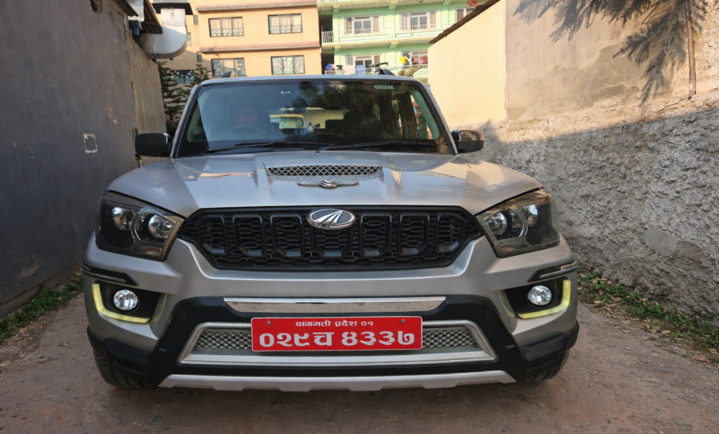
Navigating the topographical extremes of the Kali Gandaki corridor mandates highly specialized transport logistics. The shift from standard paved roads to rocky, landslide-prone tracks requires vehicles engineered for high ground clearance, robust suspension articulation, and continuous four-wheel-drive (4WD) capabilities. Transport agencies address these requirements through a fleet primarily composed of heavy-duty SUVs, such as Toyota Land Cruisers, Ford Everests, and Mahindra Scorpios. For larger groups ranging from 7 to 13 passengers, customized Toyota Hiace vans are deployed, though their viability is strictly limited to periods of dry, favorable weather when the mud tracts are minimal.
The mechanical efficacy of the vehicle is entirely dependent on the expertise of the operator. Drivers assigned to the Muktinath route represent a highly specialized cadre of mountain professionals. They possess granular, experiential knowledge of the terrain, enabling them to anticipate river crossings, bypass seasonal rockfall zones, and navigate the sheer, narrow cliff-side roads safely. Furthermore, their understanding of localized micro-climates—such as the fierce afternoon winds native to the Jomsom valley—allows them to optimize daily travel schedules to avoid hazardous driving conditions, recognizing that afternoon transit on the exposed flats near Kagbeni can be destabilizing even for heavy vehicles.
Insurance protocols form the legal and financial backbone of these operations. Legitimate transport agencies maintain comprehensive policies that cover vehicular damage against unforeseen mechanical or environmental incidents, alongside mandated passenger liability insurance in strict accordance with the Government of Nepal’s transport safety regulations, ensuring peace of mind throughout the high-risk transit.
Road Condition: Pokhara to Muktinath Complete Road Journey
The infrastructural reality of the Pokhara-to-Muktinath corridor is characterized by extreme variability. The route is not a homogenous highway but a patchwork of evolving road technologies and raw off-road wilderness. Analyzing the road conditions requires dividing the route into distinct geographic sectors.
| Segment | Distance | Topography & Surface Condition | Drive Time (Approx.) |
| Pokhara to Beni | 85 km | Blacktopped highway. Generally smooth, though localized construction and monsoon-induced potholes can cause minor delays. | 3 Hours |
| Beni to Tatopani | 21 km | Pavement ends. The route transitions to rough, gravel, and dirt tracks cut into the gorge wall. Highly susceptible to landslides and mud during the monsoon season. | 2 Hours |
| Tatopani to Marpha | 44 km | Sustained off-road conditions. Characterized by deep ruts, rocky surfaces, water crossings, and narrow cliff-side passages. High-clearance 4WD is mandatory. | 3.5 Hours |
| Marpha to Jomsom | 14 km | Gradual flattening into the river valley. The surface remains unpaved gravel, subject to high dust loads from afternoon thermal winds. | 1 Hour |
| Jomsom to Kagbeni | 11 km | Flat but heavily unpaved track running parallel to the Kali Gandaki riverbed. Fully exposed to extreme wind conditions. | 45 Minutes |
| Kagbeni to Muktinath | 14 – 21 km | Rapid ascent. This section has been recently upgraded using Double Bituminous Surface Dressing (DBSD) technology, significantly improving the final climb to the temple base. | 40 Minutes |
During the dry months of spring (March–May) and autumn (September–November), the entirety of this route is reliably passable for 4WD SUVs and Hiace vans. However, during the summer monsoon (July–August), the sector between Beni and Ghasa becomes a high-risk zone. Torrential rains trigger severe landslides, rockfalls, and deep mud bogs, frequently necessitating localized delays, heavy winch usage, or temporary road closures. Conversely, during deep winter (January–February), heavy snowfall can completely block the newly blacktopped upper sections between Kagbeni and Muktinath. When the snow freezes into hard ice on the shaded switchbacks, heavy machinery (dozers) operated by the Korala Road Project are often mobilized to clear the route, and vehicle traffic is restricted to daylight hours after the ice thaws.
Major Attractions Along the Route
The overland journey is punctuated by a series of geographic and cultural anomalies that define the trans-Himalayan experience.
1. Pokhara Functioning as the staging ground for the entire Annapurna region, Pokhara is defined by the mirror-like expanse of Phewa Lake and the towering, pyramidal backdrop of the Machhapuchhre (Fishtail) peak. Located at an elevation of 820 meters, it offers essential logistical support, permit processing offices, and recuperative luxury for travelers before and after the grueling mountain ascent.
2. Tatopani Situated deep within the narrowest section of the gorge at 1,190 meters, Tatopani translates directly to “hot water.” The village features highly sought-after natural geothermal springs situated directly along the banks of the roaring Kali Gandaki River. The mineral-rich waters are traditionally utilized by Hindu pilgrims for pre-ascent purification and by trekkers to alleviate muscular fatigue induced by the rough roads.
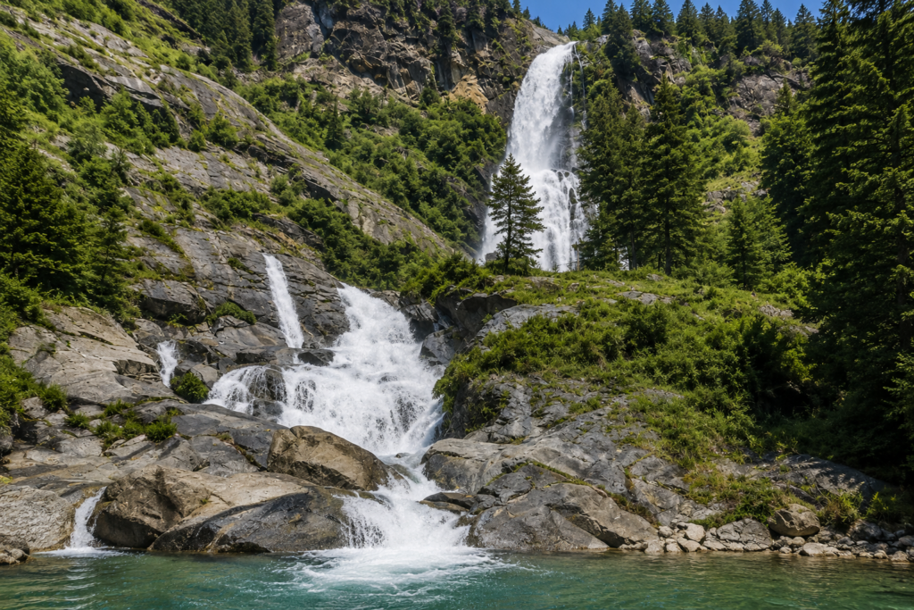
3. Rupse Waterfalls A massive natural cascade dropping over 300 meters down a sheer cliff face. Located directly adjacent to the off-road highway, it serves as a spectacular visual milestone. The force of the water eroding the rock face exemplifies the raw geological power shaping the gorge, making it a mandatory photographic halt for all overland expeditions.
4. Dhaulagiri Mountain As the seventh-highest mountain globally, towering at 8,167 meters, the Dhaulagiri massif forms the imposing western wall of the Kali Gandaki Gorge. The road provides unparalleled, close-proximity sightlines to its vast glacial icefalls and sheer rock faces, reinforcing the sheer scale of the trans-Himalayan environment and the tectonic forces that generated the region.
5. Marpha Widely recognized as the “Apple Capital of Nepal,” Marpha (2,650 meters) is an impeccably maintained Thakali village. Shielded somewhat from the harshest winds, the settlement is characterized by flat-roofed, whitewashed stone houses, flagstone-paved alleys, and a sophisticated subterranean drainage system. Its local economy thrives on extensive apple orchards, producing celebrated cider, dried apples, and the famous Marpha apple brandy.
6. Jomsom The primary administrative and commercial center of the Mustang district, Jomsom (2,743 meters) sits in a wide, barren expanse of the Kali Gandaki valley. It is meteorologically infamous for its extreme afternoon headwinds, caused by air pressure differentials channeling through the gorge. It serves as the primary overnight hub for overland travelers, hosting the region’s only airstrip.
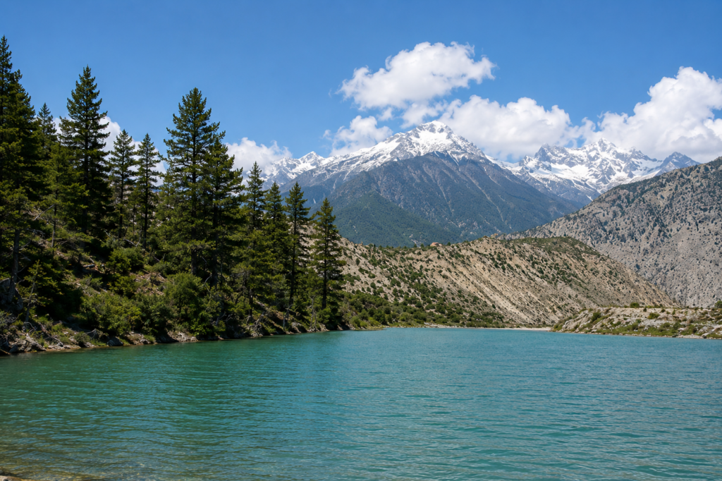
7. Dhumba Lake A highly sacred, emerald-green, high-altitude lake located just above Jomsom. Shielded from the heavy valley winds by surrounding ridges, the lake holds deep religious significance for local Buddhists and is closely associated with the nearby Khutsab Terenga Monastery. The tranquil, crystal-clear water offers a profound contrast to the harsh, arid environment surrounding it.
8. Kaligandaki River Geologically older than the Himalayas themselves, the Kali Gandaki is an antecedent river that carved its path downward as the tectonic plates collided and the mountains rose around it. Its dark, silt-heavy waters flow through the deepest gorge in the world (2,520 meters deep), acting as the sole transport mechanism carrying the sacred Shaligram fossils down from the high Tibetan plateau into Nepal and India.
9. Kagbeni A heavily fortified medieval village sitting at the confluence of the Kali Gandaki and Jhong rivers. Serving as the historic border and customs post to the forbidden kingdom of Upper Mustang, Kagbeni is steeped in Tibetan Buddhist culture. The village features ancient mud-brick monasteries, chortens, and narrow, wind-shielded alleyways designed centuries ago to protect inhabitants from the brutal valley climate.
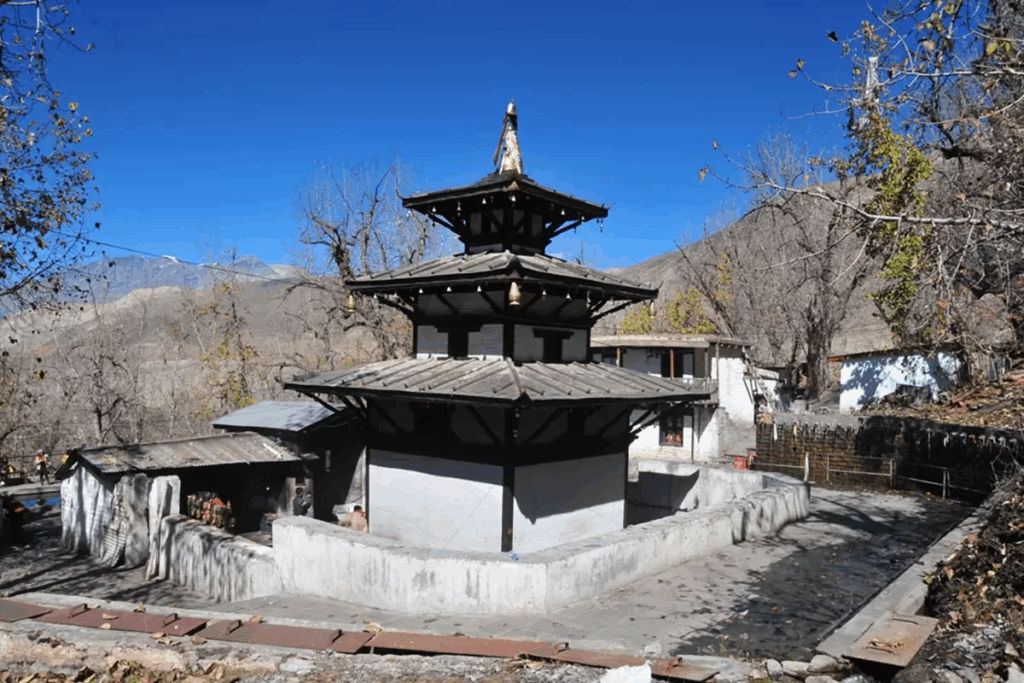
10. Muktidham (Muktinath Temple Complex) The ultimate objective of the journey. Situated at an elevation of 3,710 meters beneath the Thorong La Pass, the complex houses the central pagoda-style shrine of Lord Vishnu. The perimeter is defined by 108 glacial water spouts (Muktidhara) and two sacred purification pools (Muktikunda). It is a profound theater of religious synthesis, where Hindu Vaishnava priests and Tibetan Buddhist nuns (Jhuma) jointly manage the daily spiritual administration of the site, serving thousands of international pilgrims.
Why Choose Transport Hire Nepal
Navigating the Kali Gandaki corridor requires far more than standard car rental; it necessitates specialized mountain logistics and deep operational experience. Transport Hire Nepal distinguishes itself within the sector through a strict adherence to preventative vehicular maintenance and specialized driver deployment.
Their operational model requires that the fleet undergoes rigorous multi-point mechanical inspections prior to dispatch, ensuring suspension systems, high-clearance chassis, and four-wheel-drive mechanisms are fully optimized for off-road punishment. Furthermore, their financial model guarantees 100% transparent pricing.
| Vehicle Type | Ideal Group Size | Total Package Price (2 Days / 1 Night) | Operational Notes |
| Private SUV / Jeep (4WD) | 4 to 6 Persons | USD 250.00 | Optimal for rough road shock absorption and agility on narrow cliff passes. |
| Private Van (Hiace) | 7 to 13 Persons | USD 450.00 | Most popular for extended families; restricted to use during favorable dry-weather conditions. |
| Tourist Mini Bus | 14 to 30 Persons | USD 650.00 | Suitable for large pilgrim groups, requiring highly skilled navigation on tight switchbacks. |
Base quotes comprehensively cover the vehicle, fuel, driver accommodations, meals, road tolls, and mandated passenger insurance. This structure entirely eliminates the hidden surcharges for air-conditioning or mountain-grade fuel that plague budget operators in the region. By focusing on safety, reliability, and seamless ground support, they transform a potentially grueling and hazardous transit into a controlled, highly customizable sightseeing expedition.
Permit and Guide Requirements
Accessing the Muktinath region requires navigating the bureaucratic framework of Nepal’s conservation authorities. Because the route traverses the ecologically fragile Annapurna Conservation Area, specific permits are legally mandated for all foreign nationals to ensure environmental funding and track traveler density.
| Permit Type | Foreign Nationals (Non-SAARC) | SAARC Nationals | Nepali Citizens |
| Annapurna Conservation Area Permit (ACAP) | NPR 3,000 (~$25–$30 USD) | NPR 1,000 (~$8–$10 USD) | Free |
| Trekkers’ Information Management System (TIMS) Card | NPR 1,000 to NPR 2,000 (~$15–$20 USD) | NPR 600 to NPR 1,000 (~$5–$8 USD) | Free |
The Guide Mandate Analysis: In April 2023, the Nepal Tourism Board issued a highly publicized directive mandating the employment of licensed guides for all foreign trekkers across Nepal’s national parks to enhance safety and curb illegal, unregistered trekking operations. However, the enforcement and scope of this rule regarding vehicular overlanding are highly nuanced. While strict guide requirements have always been enforced in restricted border zones (such as Upper Mustang, which requires a $500 RAP permit), travelers executing point-to-point vehicular transit along the primary Jomsom-Muktinath highway are generally subject to more relaxed interpretations of the “trekking” rule by local authorities.
Reports from the field indicate that the TIMS card system has faced localized pushback and uneven enforcement for those traveling strictly via private jeep to Muktinath. Nevertheless, while a guide may not be strictly intercepted or mandated for passengers confined to a vehicle, engaging a licensed local guide is highly recommended by operators. A guide expertly manages the complex logistics of mountain travel, navigates linguistic barriers with local guesthouse owners, and provides vital cultural and theological context at the religious sites, significantly enhancing the expedition’s value. Professional transport agencies frequently handle the entirety of the permit procurement process on behalf of the client in Kathmandu or Pokhara, mitigating bureaucratic friction.
Best Time to Visit
The meteorological viability of the Muktinath overland route is dictated by two primary, distinct seasons, separated by periods of extreme weather that severely impact road infrastructure.
- Spring (March to May): As the harsh winter recedes, temperatures begin to warm, melting the deep snows around the Muktinath complex. Atmospheric visibility is exceptional, providing uninterrupted, crystalline views of the Dhaulagiri and Annapurna ranges. The warming weather makes the ritual bathing in the glacial Muktidhara significantly more tolerable.
- Autumn (September to November): Following the heavy monsoon, the skies are washed clear of atmospheric dust, and the rivers flow at their highest volume, making the Rupse Waterfall particularly spectacular. This period features stable temperatures and dry road conditions, representing the absolute peak season for both religious pilgrimage and international tourism.
Periods to Avoid: The summer monsoon (June to August) brings torrential precipitation to the lower elevations. The sector between Beni and Ghasa absorbs immense rainfall, triggering severe landslides, massive rockfalls, and deep mud washouts, making vehicular transit highly dangerous and unpredictable. Conversely, deep winter (December to February) brings sub-zero temperatures (- degrees Celsius) and heavy snow accumulation to Muktinath, frequently rendering the final blacktopped ascent from Kagbeni impassable without the intervention of heavy snow-clearing machinery.
Hotel and Lodge Accommodations During the Tour
The hospitality infrastructure along the Pokhara-Muktinath corridor has evolved rapidly over the past decade, transforming from basic agrarian homestays catering to rugged trekkers into an ecosystem that accommodates an expanding demographic of high-end tourists and affluent pilgrims.
In the immediate vicinity of the temple—specifically in the settlement of Ranipauwa—accommodations largely consist of standard guest houses and pilgrim lodges. These facilities are utilitarian, focused on providing basic thermal comfort, thick blankets, and proximity to the shrine for early morning rituals. However, descending into the regional hub of Jomsom, the accommodation matrix transitions into fully equipped tourist hotels offering en-suite bathrooms, consistent electricity, and diverse dining options.
At the absolute pinnacle of this regional evolution is the Shinta Mani Mustang, a globally recognized luxury eco-resort located in Jomsom. Designed by architectural visionary Bill Bensley and operated in collaboration with Sherpa Hospitality, this property integrates deeply into the local topography. The structure utilizes passive solar principles, extensive insulation, and locally sourced Baglung stone to minimize energy consumption in the harsh trans-Himalayan climate.
The resort represents a paradigm shift in mountain hospitality. With suite rates ranging from $1,890 for a Junior Suite to $2,285 per night for a Balcony Suite, the property operates on a comprehensive all-inclusive model. This pricing covers gourmet dining that elevates traditional Bon and Tibetan cuisine, privately guided cultural excursions (including treks to Dhumba Lake and Lubra village), and bespoke wellness therapies based on ancient Tibetan healing practices. The suites feature traditional Tibetan homestead styling, Irish linen bedding, upcycled furnishings, and Robert Powell artwork, all set behind expansive floor-to-ceiling windows offering unobstructed views of Mount Nilgiri. The presence of such ultra-luxury options indicates a profound socio-economic shift, proving that overland travelers can now experience the deepest isolation of the Himalayas without sacrificing world-class luxury.
The Saligram: Unique Scientific and Religious Description
The Kali Gandaki River represents an extraordinary intersection of paleontology and theology, functioning as the exclusive global source for the Shaligram stone. This duality elevates the riverbed near Kagbeni from a mere geological site to a focal point of intense global reverence.
Scientific Provenance: From a strict paleontological and geological perspective, Shaligrams are the fossilized remains of ammonites—extinct, coiled marine cephalopods belonging to the subclass Ammonoidea. Specifically, these stones are dense black shales containing fossils of genera such as Blandifordiceras, Haplophylloceras, and Aulacosphinctoides. Approximately 140 to 166 million years ago, during the Middle Jurassic to Early Cretaceous periods, these creatures inhabited the outer shelf of the Neotethys Ocean, a massive equatorial seaway separating the supercontinents of Laurasia and Gondwana. When the Indian tectonic plate collided with the Eurasian plate—buckling the earth’s crust to form the Himalayas—the ancient ocean floor was thrust thousands of meters into the sky. Today, glacial melt and aggressive riverine erosion slowly carve these ancient marine fossils out of the high-altitude Spiti Shales, depositing the rounded black stones along the Kali Gandaki riverbed.
Religious Significance: In Hindu theology, the scientific reality of the Shaligram is entirely superseded by its profound cosmic significance. Ancient Puranic texts—including the Skanda Purana and Padma Purana—dictate that Lord Vishnu, following a complex curse levied by the virtuous Tulasi (the wife of the demon king Jalandhara), was physically transformed into a stone. Consequently, the Shaligram is not interpreted merely as a symbolic representation of Vishnu; it is revered as a swayambhu (self-manifested) deity containing his inherent, living divine presence.
Unlike crafted temple idols, Shaligrams require no elaborate pran pratishtha (consecration rituals). The distinct, mathematically precise spiral formations and radial ribs visible on the fossils are interpreted by devotees as the literal marks of Vishnu’s divine discus (chakra), carved by celestial worms (Vajra-keeta). Pilgrims scour the freezing riverbanks to secure these sacred stones, governed by the strict rule that true Shaligrams cannot be bought or sold for monetary value. It is believed that worshipping a genuine Shaligram inside the home, or consuming water that has washed over it, expunges all sin, invokes cosmic protection, and guarantees ultimate liberation (Moksha) from the cycle of rebirth.
FAQ
1. Is it safe to drive the overland route from Pokhara to Muktinath? Yes, provided the journey is undertaken with the correct logistical parameters. It requires a high-clearance 4WD vehicle (or specialized Hiace van) operated by an experienced mountain driver. While the central gorge sections are unpaved, narrow, and subject to seasonal rockfalls, commercial transport agencies mitigate these risks through rigorous vehicle maintenance, weather monitoring, and deploying drivers intimately familiar with the terrain’s hazards.
2. How long does the actual overland trip take from Pokhara to Muktinath? The pure point-to-point driving time spans approximately 8 to 10 hours depending on localized traffic, road construction delays, and checkpoint clearances. However, attempting this in a single day is highly discouraged due to extreme fatigue and the risk of rapid altitude gain. It is highly recommended to split the journey over two days, staging an overnight halt in Jomsom to manage biological acclimatization and break up the physical toll of the off-road transit.
3. Do I need an ACAP and TIMS permit if I am only driving and not trekking? Yes. The entirety of the Mustang region, including the motorable highway, falls under the jurisdiction of the Annapurna Conservation Area Project (ACAP). Regardless of whether you are trekking on foot or transiting in a private, climate-controlled jeep, all foreign travelers must secure the ACAP permit and generally the TIMS registration before crossing the regional checkpoints.
4. Can elderly pilgrims safely visit the Muktinath complex via road? Absolutely. The expansion of the road network and the availability of comfortable, shock-absorbing SUVs have democratized access, making the pilgrimage highly viable for senior citizens who cannot trek. It is advised, however, that elderly travelers consult a physician regarding the 3,710-meter altitude, plan for a gradual ascent with an overnight in Jomsom, and utilize pony rentals for the final 30-minute incline from the jeep drop-off to the temple.
5. What is the optimal vehicle choice for the Muktinath trip? For small groups or families (4-6 people), a robust 4WD SUV like a Toyota Land Cruiser or Mahindra Scorpio is the optimal choice for navigating the rough terrain and deep ruts of the gorge. For larger groups (7-13 people), a specialized, high-clearance Toyota Hiace van is frequently deployed, though its use is strictly limited to periods of dry weather when mud traction is not an issue.
6. Why are the afternoon winds in Jomsom so notorious? The Kali Gandaki valley functions as a massive, geological wind funnel. By midday, intense solar radiation heats the arid Tibetan plateau to the north, causing the air to rise. Cooler, denser air from the southern plains rushes up the narrow gorge to replace it, generating daily, high-velocity gale winds that complicate afternoon transit, whip up blinding dust storms, and occasionally destabilize high-profile vehicles on exposed tracks.
7. Can Indian citizens travel easily from Gorakhpur or Raxaul? Yes. Both Gorakhpur (via the Sunauli border) and Raxaul serve as massive, highly efficient transit hubs for Indian pilgrims. Indian citizens do not require a visa for Nepal but must carry a valid Passport or Voter ID for border clearance. The travel time from either border crossing to the staging city of Pokhara ranges from 9 to 12 hours of driving.
8. Why is the Muktinath temple considered sacred to both Hindus and Buddhists? The site represents a rare pinnacle of religious synthesis. Hindus revere it as one of the 108 Divya Desams and a Swayam Vyakta Kshetra (self-manifested shrine), a place of ultimate salvation (Moksha) dedicated to Lord Vishnu, who was freed from a curse here. Simultaneously, Tibetan Buddhists know the site as Chumig Gyatsa (Hundred Waters), an intensely sacred Tantric sanctuary associated with the enlightenment of the great master Padmasambhava (Guru Rinpoche).
9. Are there luxury accommodations available in the remote Mustang region? Yes. While standard lodges dominate, the region’s socio-economic profile has expanded to host world-class luxury eco-resorts. Notably, the Shinta Mani Mustang in Jomsom offers an all-inclusive luxury experience, featuring climate-controlled suites, gourmet dining, and bespoke Tibetan wellness therapies, proving that high-end hospitality is now viable in the deep Himalayas.
10. What are the essential packing requirements for the Muktinath road trip? Travelers must pack in highly adaptable layers, preparing for humid, subtropical conditions in Pokhara and near-freezing, wind-swept temperatures at the temple complex. Essentials include heavy windproof jackets, thermal base layers, dust protection (masks/scarves) to combat the Jomsom winds, sturdy footwear for the rocky temple precincts, and altitude sickness medication (Diamox) if previously recommended by a physician.
Recap
The overland expedition from the central valleys of Nepal to the sacred heights of Muktinath stands as a monumental testament to both human engineering and enduring spiritual devotion. By bridging the massive topographical divide of the Kali Gandaki Gorge with capable 4WD logistics, this once-arduous, month-long trek has been transformed into a highly accessible, profound road journey. From the awe-inspiring verticality of the Dhaulagiri massif and the Rupse Waterfalls to the deep tectonic history locked within the Jurassic Shaligram fossils, every kilometer of the route offers a dense concentration of geographic and cultural heritage. Ultimately, arriving at the 108 freezing glacial spouts and the eternal flame of the Muktinath Temple provides a rare moment of philosophical synthesis—a space where extreme trans-Himalayan geography meets the harmonious convergence of Hindu and Buddhist theology, granting liberation, context, and peace to all who make the ascent.